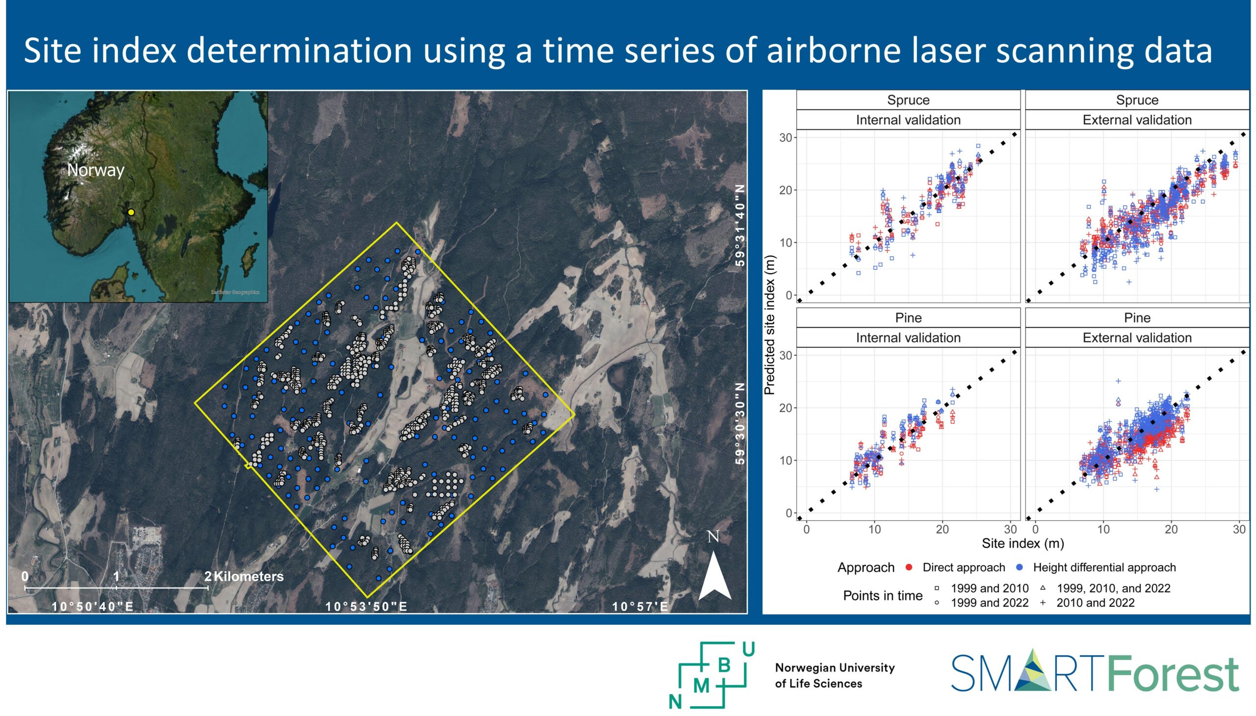
A new SmartForest publication on “Site index determination using a time series of airborne laser scanning data” just got published!
Congratulations to the authors Maria Åsnes Moan, Ole Martin Bollandsås, Svetlana Saarrela, Terje Gobakken, Erik Næsset, Hans Ole Ørka and Lennart Noordermeer! 👏
🌲 Site index (SI) is determined from the top height development and is a proxy for forest productivity, defined as the expected top height for a given species at a certain index age.
In Norway, an index age of 40 years is used.
The use of bi-temporal airborne laser scanning (ALS) data, allows SI determination using models estimated from SI observed on field plots (the direct approach) or from predicted top heights at two points in time (the height differential approach).
Using a time series of airborne laser scanning (ALS) data might increase the accuracy of SI determination compared to using data from two consecutive ALS acquisitions. This is because a longer period of the top height development will be represented.
The authors used a time series of ALS data from three points in time to determine SI with the direct and height differential approach.
The prediction errors were not statistically significantly different when using the full length of the time series of ALS data compared to using ALS data from two consecutive points in time, i.e., either first and second or second and third point in time.
However, the area suitable for SI determination increased when any subset of consecutive points in time from the time series could be used for SI determination due to increased flexibility to avoid using periods where disturbances had occurred.
read the full article here: https://www.sciencedirect.com/science/article/pii/S2197562024001040

