
We are happy to share some insights from our research team on large area mapping of retention trees at NMBU, Forest Inventory and Monitoring Research Group, with Marie-Claude Jutras-Perreault and Hans Ole Ørka.
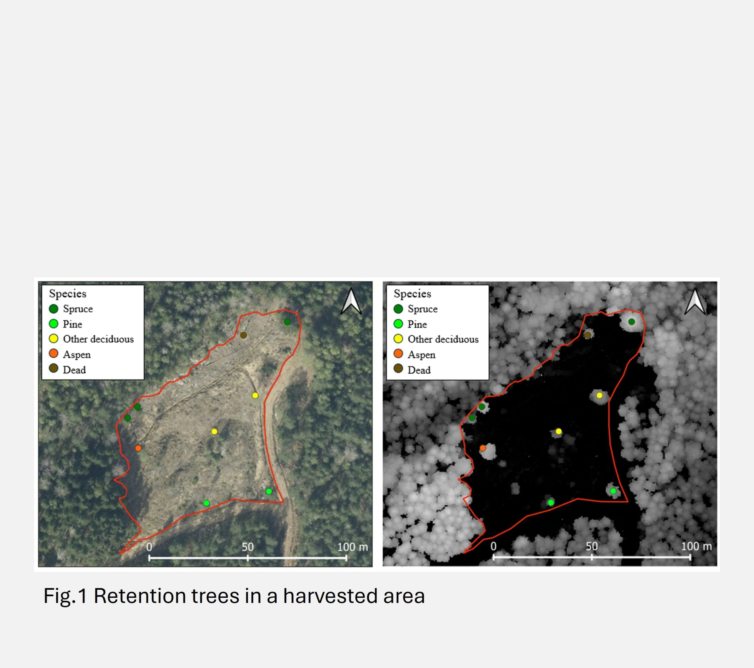
Clear-cutting can resemble natural disturbances like forest fire, but key differences exist in biological legacy. One way to reduce this difference is by preserving structural features of old forests within harvested areas, such as retention trees. The latest Programme for the Endorsement of Forest Certification (PEFC) standards require not only the preservation of retention trees but also their mapping and management in databases. To support mapping of previous harvested areas in forest management inventories or larger areas, cost-effective methods that utilize airborne laser scanning (ALS) data and minimal field measurements are essential.
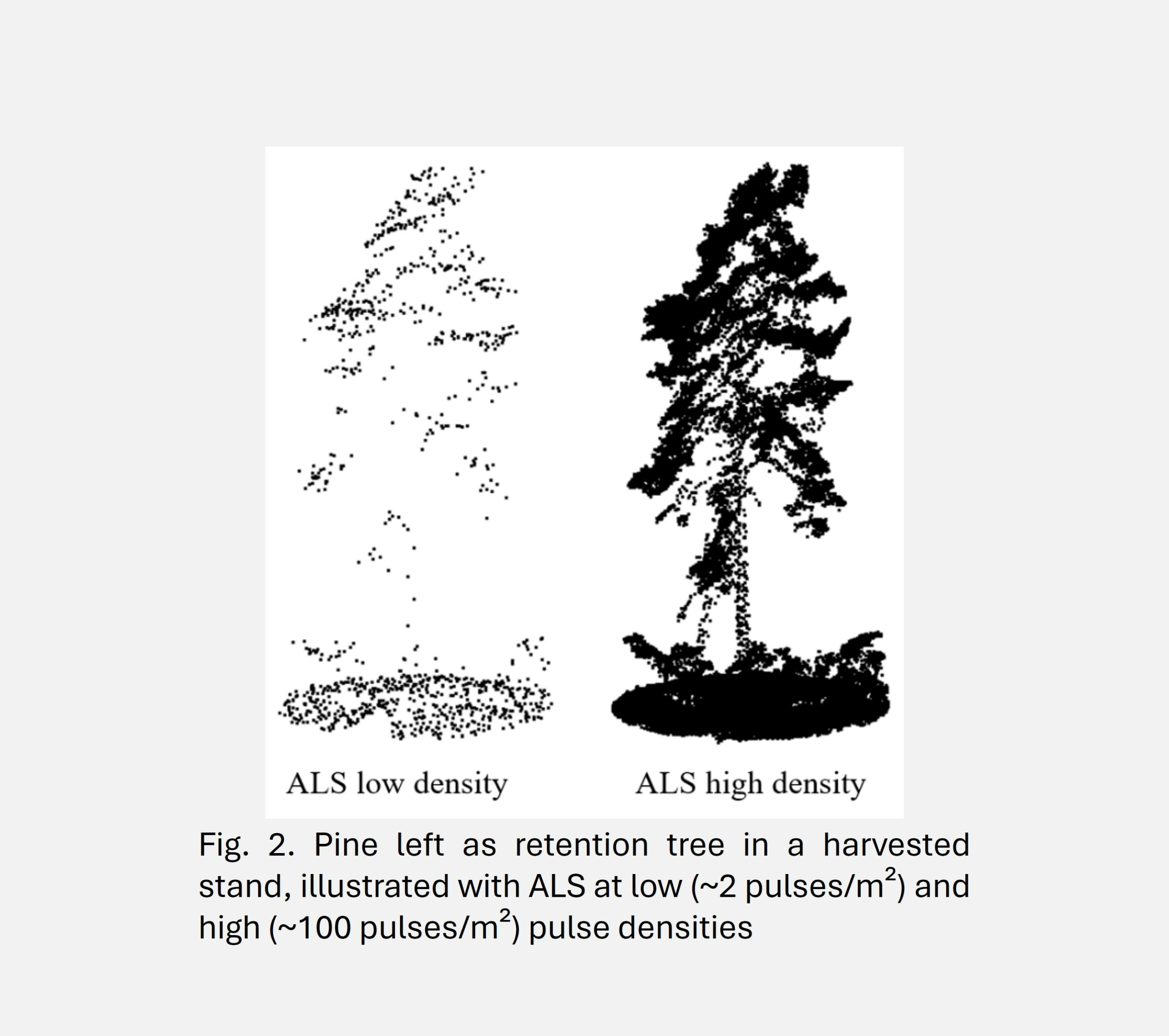
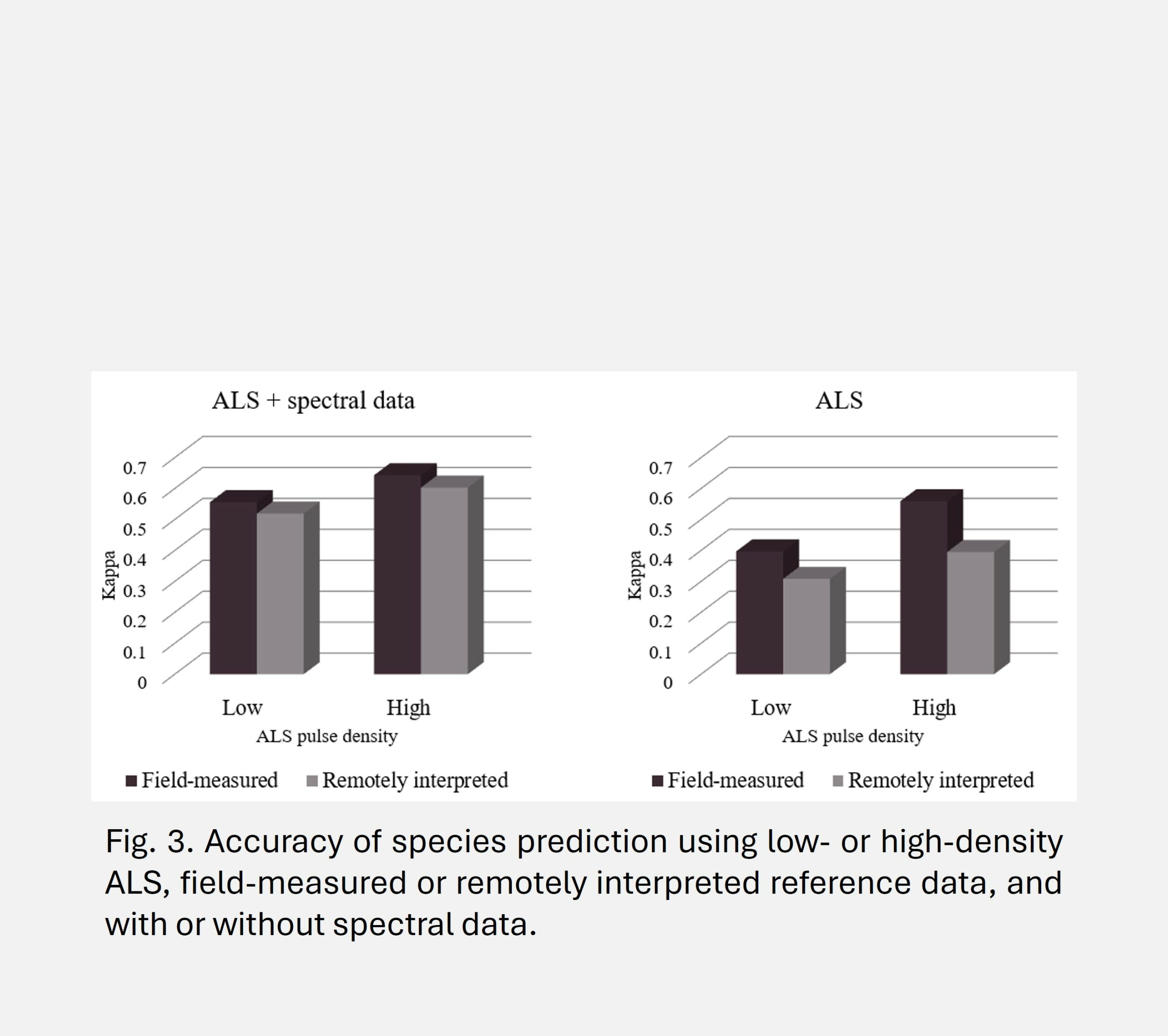
We evaluated the accuracy of stand-level retention tree density and volume predictions using ALS data with low (2 pulses/m2) and high (~100 pulses/m2) pulse densities (Fig. 2), both with and without spectral data acquired from airborne sensors. Additionally, we assessed the feasibility of large-area predictions using a limited number of field-measured reference trees (40 retention trees), complemented by remotely interpreted reference data.
Results indicate that low-density ALS data provides reliable estimates of total retention tree density and volume (not displayed), supporting its suitability for large-area mapping. While spectral data improved species classification, prediction accuracy remained consistent across field-measured and remotely interpreted reference sources, with kappa values of 0.56 and 0.52, respectively, when spectral data were combined with ALS data (Fig. 3).
To enable scalable mapping of retention trees using national ALS datasets, our findings suggest that a hybrid approach combining low-density ALS data with targeted field sampling is effective. A limited sample of approximately 40 field-measured retention trees for diameter-height modeling, combined with remotely interpreted reference data for species classification, balances accuracy and efficiency.
This approach facilitates nationwide monitoring efforts and enables retrospective analysis using existing ALS and orthophoto datasets, ultimately improving the accessibility and reliability of retention tree data for sustainable forest management. Additionally, it potentially provides tools for semi-automatic reporting for certification and virtual audits. Furthermore, the methodology can be used to improve data quality in retention tree databases and support pre-harvest mapping of potential retention trees.