
Can aerial photographs offer a practical alternative to laser scanning for AI-based forest stand mapping?
A newly published SmartForest study explores how different remote sensing data combinations support automated forest stand delineation—a task that until today remains largely manual, time-consuming and dependent on expert interpretation.
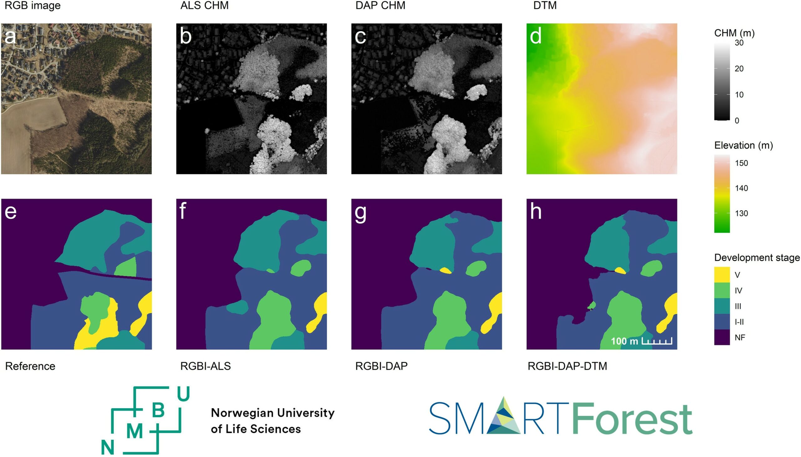
The authors Håkon Næss Sandum, Hans Ole Ørka, Oliver Tomic and Terje Gobakken from NMBU tested a deep learning framework across six municipalities in southeastern Norway, combining aerial imagery with canopy height models derived from either airborne laser scanning or aerial photogrammetry.
Key findings: 🔹 All tested data combinations delivered comparable performance, with overall accuracy of 90–91%. 🔹 Canopy height models derived from aerial photographs performed similarly to those based on laser scanning, despite capturing less structural detail. 🔹 Adding a digital terrain model provided little additional benefit under the conditions examined.
An important insight: The models agreed more closely with each other than with the expert-drawn reference maps—highlighting that differences from human-drawn boundaries may partly reflect subjective interpretation rather than model errors.
Why does this matter? Using aerial photographs for both imagery and canopy height information could reduce challenges caused by data collected at different times, supporting more scalable automated forest stand mapping.
📄 paper title: Assessing airborne laser scanning and aerial photogrammetry for convolutional neural network-based semantic segmentation of forest stands
📚 published in: Forestry: An International Journal of Forest Research
Read the article here https://doi.org/10.1093/forestry/cpag088