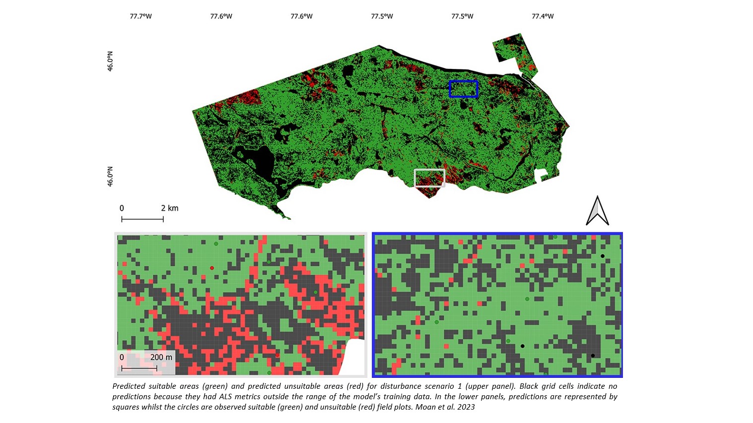
Bitemporal airborne laser scanning data is more and more used in forest management inventories to determine site index. However, accurate site index determination using this data relies on undisturbed height growth of dominant trees. Consequently, areas with disrupted top height development are unsuitable for site index determination. To ensure reliable modeling, prediction, and estimation of site index with bitemporal airborne laser scanning data, it is crucial to identify and exclude these disturbed areas beforehand.
Maria Åsnes Moan, Lennart Noordermeer, Joanne C White, Nicholas C Coops and Ole Martin Bollandsås just published a paper on “Detecting and excluding disturbed forest areas improves site index determination using bitemporal airborne laser scanner data” in their work related to SmartForest in Forestry: An International Journal of Forest Research, and demonstrated that in complex temperate mixedwood forests, bitemporal ALS data can effectively distinguish between disturbed and undisturbed forest areas with moderate to high accuracy. Moreover, the exclusion of disturbed forest areas was found to significantly enhance the accuracy of site index prediction models, as reflected in improved fit statistics.