A new article was just published on “Estimating wood quality attributes from dense airborne LiDAR point clouds” in Forest Ecosystems!
Congratulations to Nicolas Cattaneo, Stefano Puliti, Carolin Fischer and Rasmus Astrup!
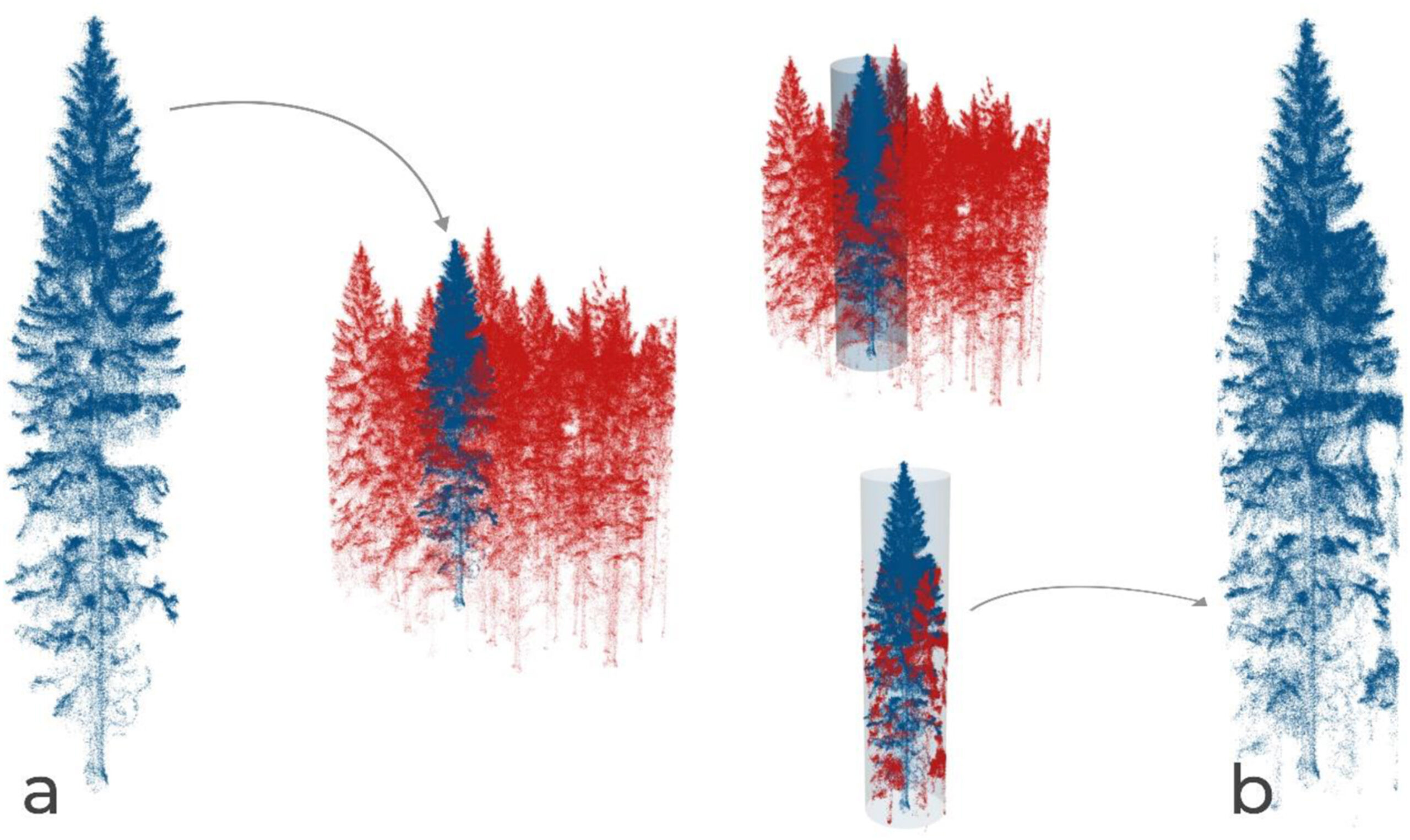
Mapping individual tree quality parameters from high-density LiDAR point clouds is an important step towards improved forest inventories. The authors present a novel machine learning-based workflow that uses individual tree point clouds from drone laser scanning to predict wood quality indicators in standing trees. Unlike object reconstruction methods, their approach is based on simple metrics computed on vertical slices that summarize information on point distances, angles, and geometric attributes of the space between and around the points. Their models use these slice metrics as predictors and achieve high accuracy for predicting the diameter of the largest branch per log (DLBs) and stem diameter at different heights (DS) from survey-grade drone laser scans. They show that these models are also robust and accurate when tested on suboptimal versions of the data generated by reductions in the number of points or emulations of suboptimal single-tree segmentation scenarios. The approach provides a simple, clear, and scalable solution that can be adapted to different situations both for research and more operational mapping.